Know the Trail. Plan the Ride.
Off-road trail maps with ratings, 3D terrain, and public land boundaries. Create a group ride from any trail.
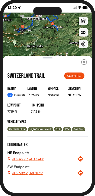
Trail Details
Curated Trail Ratings
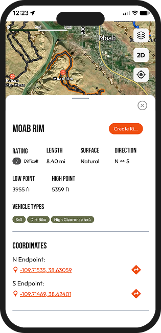
Rated trails show a difficulty level alongside length, surface, direction of travel, and elevation. Vehicle types designated by the managing agency are included to help match a trail to your vehicle and experience level.
- Difficulty rating, length, and surface
- High and low point elevation
- Approved vehicle types designated by the managing agency
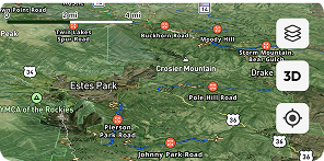
Satellite and 3D maps
Study the terrain, switch map layers, and view trails in 3D before you go.
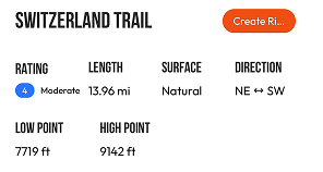
Details at a glance
Rating, length, surface, direction, and elevation in one place.
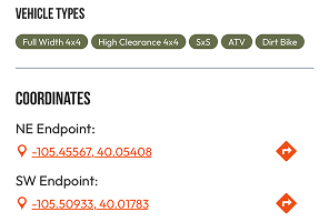
The right trail for your vehicle
Agency-designated vehicle types and endpoint coordinates are included with each trail.
See the Terrain
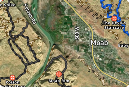
Satellite imagery gives you a clear picture of the terrain before you commit to a route. Trails and points of interest are shown directly on the map.
- Satellite imagery of the terrain
- Trails shown on the imagery
- Points of interest on the map
Choose Your View
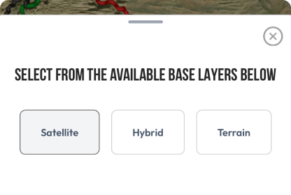
Switch between map layers to see the information that matters for your plan. Trails and points of interest stay on the map as you change views.
- Switch between map layers
- View trails in context
- Trails and points of interest on the map
Explore in 3D
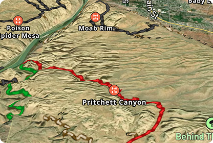
Switch the map into 3D mode to see the terrain before you arrive. Trails appear directly on the 3D map, so you can visualize the elevation changes.
- 3D terrain view
- Elevation changes at a glance
- Trails drawn on the 3D map
Ride Together
From Trail to Planned Ride
Create a ride directly from any trail details. Choose the date and meeting point, invite your group, and keep everyone informed about the ride.
- Create Ride from any trail page
- Invite your group and track RSVPs
- Everyone stays up-to-date on the ride details
Download
UNLOCK YOUR OUTDOORS
Plan rides. Group coordination. Outdoor community.
Public Lands
Know Your Public Lands
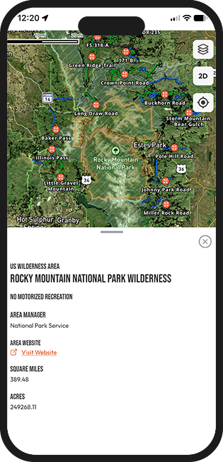
See where public lands begin and end, and which agency manages them, anywhere in the country. Responsible recreation is understanding where you are and which rules may apply.
- Land managed by the U.S. Forest Service (USFS)
- Land managed by the Bureau of Land Management (BLM)
- Land managed by the National Park Service (NPS)
- Designated Wilderness areas, which are generally closed to motorized vehicles
Become an Outryder
Where community begins
Questions
Find answers about Outryd, how it works, and getting started.
Outryd's trail maps let you explore off-road trails with ratings, satellite imagery, map layers, and 3D terrain. You can view trail details, check public land boundaries, and create a group ride from any trail.
Each trail page brings the key details together: difficulty rating (where available), length, surface, direction, and elevation. You'll also see vehicle types designated by the managing agency and endpoint coordinates, so you can decide whether a trail fits your plans.
No. Not every trail has a rating at this time. Where one is available, it appears with the trail's other details on a scale of 1 to 10.
Outryd assigns ratings by running each rated trail and evaluating its difficulty, on a scale of 1 to 10. Conditions can change, so treat a rating as a starting point for your own judgment.
Trail details list the vehicle types designated by the managing public agency, such as 4x4, Full-Width, ATV, SxS, and dirt bike. Full-Width refers to vehicles 72 inches wide or larger. Rules vary by road and trail, so some routes do not allow every vehicle type. Check current agency maps and posted signs before you go.
Outryd shows nationwide public land boundaries, including land managed by the U.S. Forest Service, Bureau of Land Management, National Parks, and Designated Wilderness areas.
Every trail on the Outryd map is located on public land, and trail data is imported from public sources.
Yes. Once you find a trail you want to ride, click the "Create Ride" button and invite your friends.
Partly. An open map remains available without a connection because its tiles are cached on your device. Selecting a trail or other map feature to load its details requires an internet connection.
Out·ry·der |'aut-ˌrī-der|
noun
An Outryder believes the best adventures are co-built. Not just by the trails taken, but by the knowledge shared. They believe in clarity over uncertainty. In access over ego. In connection over competition. With curiosity as their compass, and community as their guide.